産業
El Monteにおける業界別ビジネス分布
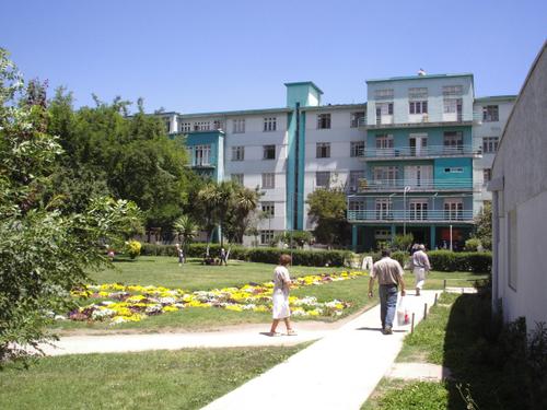
El Monteの地図
インタラクティブマップ
El Monteの人口
1975年から2030年
| Data | 1975 | 1990 | 2000 | 2015 | 2020 | 2025* | 2030* |
|---|---|---|---|---|---|---|---|
| 人口 | 11,458 | 17,778 | 21,247 | 26,408 | 29,696 | 31,512 | 33,355 |
| 人口密度 | 279.5 / km² | 433.6 / km² | 518.2 / km² | 644.1 / km² | 724.3 / km² | 768.6 / km² | 813.5 / km² |
* 予測値
情報源: JRC (European Commission's Joint Research Centre) の作業 GHS built-up gridEl Monteの2000年から2020年までの人口変化
2000年から2020年にかけて39.8%増加
| 場所 | 1975年以降の変化 | 1990年以降の変化 | 2000年以降の変化 |
|---|---|---|---|
| El Monte | +159.2% | +67% | +39.8% |
| 首都州 (チリ) | — | — | — |
| チリ | — | — | — |
情報源: JRC (European Commission's Joint Research Centre) の作業 GHS built-up grid
El Monteの年齢中央値
年齢中央値: 28.5歳
| 場所 | 平均年齢 | 年齢の中央値(女性) | 年齢の中央値(男性) |
|---|---|---|---|
| El Monte | 28.5 yrs | 29 yrs | 27.9 yrs |
| 首都州 (チリ) | 31.3 yrs | 32.2 yrs | 30.3 yrs |
| チリ | 31.3 yrs | 32 yrs | 30.6 yrs |
情報源: CIESIN (Center for International Earth Science Information Network)
El Monteの人口密度
人口密度: 724 / km²
| 場所 | 人口 | エリア | 密度 |
|---|---|---|---|
| El Monte | 29,696 | 41 km² | 724 / km² |
| 首都州 (チリ) | 7.3 million | 15,392.3 km² | 477 / km² |
| チリ | 17.8 million | 751,744.8 km² | 23.7 / km² |
情報源: JRC (European Commission's Joint Research Centre) の作業 GHS built-up grid
El Monteの過去および予測人口
1760年から2100年までの推定人口
情報源:
- JRC (European Commission's Joint Research Centre) の作業 GHS built-up grid
- CIESIN (Center for International Earth Science Information Network)
- [リンク] Klein Goldewijk, K., Beusen, A., Doelman, J., and Stehfest, E.: Anthropogenic land use estimates for the Holocene – HYDE 3.2, Earth Syst. Sci. Data, 9, 927–953, https://doi.org/10.5194/essd-9-927-2017, 2017.
価格分布
El Monteの価格によるビジネスの分布
人間開発指数(HDI)
平均余命、教育、および一人当たり収入の統計的複合指数。
出典: [リンク] Kummu, M., Taka, M. &Guillaume, J. 1990年から2015年までのGDPおよび人間開発指数のグローバルグリッドデータセット. Sci Data 5, 180004 (2018) doi:10.1038/sdata.2018.4
El Monteの国内総生産(GDP)
一人当たりGDP、購買力平価(2017年国際ドル固定)
| Data | 1990 | 1995 | 2000 | 2005 | 2010 | 2015 | 2020 | 2022 |
|---|---|---|---|---|---|---|---|---|
| 一人当たりGDP | $21,275 | $27,140 | $28,611 | $42,176 | $51,120 | $52,197 | $46,725 | $49,096 |
| GDP総額 | $4268.7万 | $5862.8万 | $6476.8万 | $9301.2万 | $1.1億 | $1.1億 | $1.1億 | $1.2億 |
出典: [リンク] Kummu, M., Kosonen, M. & Masoumzadeh Sayyar, S. Downscaled gridded global dataset for gross domestic product (GDP) per capita PPP over 1990–2022. Sci Data 12, 178 (2025) doi:10.1038/s41597-025-04487-x
El MonteのCO2排出量
1人あたりの二酸化炭素(CO2)排出量(年間トン)
| 場所 | CO2排出量 | 一人当たりのCO2排出量 | CO2排出強度 |
|---|---|---|---|
| El Monte | 158,413 tn | 5.33 tn | 3,863.7 tons/km² |
| 首都州 (チリ) | 39,719,045 tn | 5.42 tn | 2,580.5 tons/km² |
| チリ | 87,296,657 tn | 4.91 tn | 116.1 tons/km² |
情報源: [リンク] Moran, D., Kanemoto K; Jiborn, M., Wood, R., Többen, J., and Seto, K.C. (2018) 13,000都市のカーボンフットプリント. Environmental Research Letters DOI: 10.1088/1748-9326/aac72a
El MonteのCO2排出量
| 2013年のCO2排出量(トン/年) | 158,413 tn |
| 2013年の一人当たりCO2排出量(トン/年) | 5.33 tn |
| 2013年のCO2排出強度(トン/km²/年) | 3,863.7 tons/km² |
自然災害リスク
10のうちの相対リスク
| ハザード | リスクレベル |
|---|---|
| 干ばつ | 高 (10) |
| 洪水 | 高 (10) |
| 地震 | 高 (9) |
| 地すべり | 中 (7) |
*特に洪水または地滑りに関するリスクは、地域全体に及ぶとは限りません。
情報源:
- Dilley, M., R.S. Chen, U. Deichmann, A.L. Lerner-Lam, M. Arnold, J. Agwe, P. Buys, O. Kjekstad, B. Lyon, and G. Yetman. 2005. Natural Disaster Hotspots: A Global Risk Analysis. Washington, D.C.: World Bank. https://doi.org/10.1596/0-8213-5930-4.
- Center for Hazards and Risk Research - CHRR - Columbia University, Center for International Earth Science Information Network - CIESIN - Columbia University, and Norwegian Geotechnical Institute - NGI. 2005. Global Landslide Hazard Distribution. Palisades, NY: NASA Socioeconomic Data and Applications Center (SEDAC). https://doi.org/10.7927/H4P848VZ.
- Center for Hazards and Risk Research - CHRR - Columbia University, Center for International Earth Science Information Network - CIESIN - Columbia University, and International Research Institute for Climate and Society - IRI - Columbia University. 2005. Global Drought Hazard Frequency and Distribution. Palisades, NY: NASA Socioeconomic Data and Applications Center (SEDAC). https://doi.org/10.7927/H4VX0DFT.
- Center for Hazards and Risk Research - CHRR - Columbia University, Center for International Earth Science Information Network - CIESIN - Columbia University. 2005. Global Flood Hazard Frequency and Distribution. Palisades, NY: NASA Socioeconomic Data and Applications Center (SEDAC). https://doi.org/10.7927/H4668B3D.
- Center for Hazards and Risk Research - CHRR - Columbia University, Center for International Earth Science Information Network - CIESIN - Columbia University. 2005. Global Earthquake Hazard Distribution - Peak Ground Acceleration. Palisades, NY: NASA Socioeconomic Data and Applications Center (SEDAC). https://doi.org/10.7927/H4BZ63ZS.
最近の近くの地震
マグニチュード3.0以上
| 日付▼ | 時間↕ | Magnitude↕ | Distance↕ | 深さ↕ | 場所↕ | リンク |
|---|---|---|---|---|---|---|
| 3/11/19 | 2:22 PM | 4.1 | 19.2 km | 82,280 m | 12km W of Paine, Chile | usgs.gov |
| 4/7/18 | 5:35 PM | 3.9 | 11.7 km | 80,560 m | 2km N of Penaflor, Chile | usgs.gov |
| 4/1/15 | 3:54 PM | 4.1 | 7.8 km | 66,500 m | 6km S of El Monte, Chile | usgs.gov |
| 1/15/15 | 5:19 AM | 4.3 | 10.4 km | 68,200 m | 7km W of El Monte, Chile | usgs.gov |
| 12/18/12 | 12:45 AM | 3.9 | 19.1 km | 65,900 m | Region Metropolitana, Chile | usgs.gov |
| 11/14/08 | 6:11 AM | 3.9 | 20.2 km | 72,400 m | Region Metropolitana, Chile | usgs.gov |
| 8/28/08 | 6:09 AM | 3 | 13.3 km | 78,300 m | Region Metropolitana, Chile | usgs.gov |
| 6/12/08 | 11:20 PM | 3.6 | 16.9 km | 64,000 m | Region Metropolitana, Chile | usgs.gov |
| 2/29/08 | 3:09 AM | 4.1 | 19 km | 67,900 m | Region Metropolitana, Chile | usgs.gov |
| 8/14/07 | 7:55 PM | 3.3 | 18.9 km | 74,100 m | Region Metropolitana, Chile | usgs.gov |


データについて
このページのデータは、公開されている各種ツールやリソースを用いて推定されています。保証なしで提供されており、不正確な情報が含まれる可能性があります。ご自身の責任でご利用ください。