Aidipsósのカテゴリー
ガソリンスタンド服屋ギリシャ正教会教会住宅開発観光名所アイスクリーム店カクテル バーカフェカフェテリアキャンディショップギリシャ料理レストランコーヒーショップシーフードレストランスモールプレートレストランチョップハウスバー・パブ・居酒屋バーベキュー店ピザベーカリーレストラン食料雑貨品店・スーパーマーケットメディカル スパサービスアパートメントマンスリー マンション ビル旅行者用アパート貸別荘ギフト ショップショッピングスーパー化粧品店薬局アドベンチャー・アウトドアアクティビティ水上レクリエーション遊び場ヴィラツアーフェリー サービスホテルホテル・モーテルリゾート宿泊施設旅行代理業民宿自炊式宿泊施設
産業
Aidipsósにおける業界別ビジネス分布
Aidipsósのデータ
| エリア | 119.5 km² |
| 人口 | 5,075 |
| 男性人口 | 2,503 (49.3%) |
| 女性人口 | 2,572 (50.7%) |
| 人口変化 (1975 to 2020) | +1.5% |
| 人口変化 (2000 to 2020) | -14.2% |
| 平均年齢 | 48.1歳 (男性: 46.3, 女性: 50) |
| 一人当たりGDP(購買力平価) | $27,635 (2022) |
| 現地時間 | |
| 時間帯 | 東ヨーロッパ夏時間 |
| 緯度と経度 | 38.87924, 23.04691 |
| 郵便番号 | 343 00 |
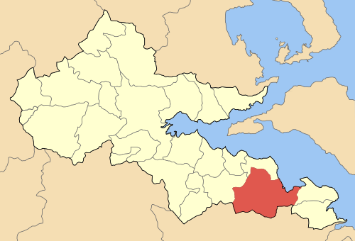
Aidipsósの地図
インタラクティブマップ
Aidipsósの人口
1975年から2030年
| Data | 1975 | 1990 | 2000 | 2015 | 2020 | 2025* | 2030* |
|---|---|---|---|---|---|---|---|
| 人口 | 5,000 | 5,515 | 5,913 | 5,836 | 5,075 | 4,893 | 4,720 |
| 人口密度 | 41.8 / km² | 46.2 / km² | 49.5 / km² | 48.8 / km² | 42.5 / km² | 40.9 / km² | 39.5 / km² |
* 予測値
情報源: JRC (European Commission's Joint Research Centre) の作業 GHS built-up gridAidipsósの2000年から2020年までの人口変化
2000年から2020年にかけて14.2%減少
| 場所 | 1975年以降の変化 | 1990年以降の変化 | 2000年以降の変化 |
|---|---|---|---|
| Aidipsós | +1.5% | -8% | -14.2% |
| 中央ギリシャ | — | — | — |
| ギリシャ | — | — | — |
情報源: JRC (European Commission's Joint Research Centre) の作業 GHS built-up grid
Aidipsósの年齢中央値
年齢中央値: 48.1歳
| 場所 | 平均年齢 | 年齢の中央値(女性) | 年齢の中央値(男性) |
|---|---|---|---|
| Aidipsós | 48.1 yrs | 50 yrs | 46.3 yrs |
| 中央ギリシャ | 43.5 yrs | 45.2 yrs | 41.9 yrs |
| ギリシャ | 41.8 yrs | 43.1 yrs | 40.5 yrs |
情報源: CIESIN (Center for International Earth Science Information Network)
Aidipsósの人口密度
人口密度: 42.5 / km²
| 場所 | 人口 | エリア | 密度 |
|---|---|---|---|
| Aidipsós | 5,075 | 119.5 km² | 42.5 / km² |
| 中央ギリシャ | 534,502 | 15,673.8 km² | 34.1 / km² |
| ギリシャ | 10.7 million | 132,689.5 km² | 80.4 / km² |
情報源: JRC (European Commission's Joint Research Centre) の作業 GHS built-up grid
Aidipsósの過去および予測人口
0年から2100年までの推定人口
情報源:
- JRC (European Commission's Joint Research Centre) の作業 GHS built-up grid
- CIESIN (Center for International Earth Science Information Network)
- [リンク] Klein Goldewijk, K., Beusen, A., Doelman, J., and Stehfest, E.: Anthropogenic land use estimates for the Holocene – HYDE 3.2, Earth Syst. Sci. Data, 9, 927–953, https://doi.org/10.5194/essd-9-927-2017, 2017.
価格分布
Aidipsósの価格によるビジネスの分布
人間開発指数(HDI)
平均余命、教育、および一人当たり収入の統計的複合指数。
出典: [リンク] Kummu, M., Taka, M. &Guillaume, J. 1990年から2015年までのGDPおよび人間開発指数のグローバルグリッドデータセット. Sci Data 5, 180004 (2018) doi:10.1038/sdata.2018.4
Aidipsósの国内総生産(GDP)
一人当たりGDP、購買力平価(2017年国際ドル固定)
| Data | 1990 | 1995 | 2000 | 2005 | 2010 | 2015 | 2020 | 2022 |
|---|---|---|---|---|---|---|---|---|
| 一人当たりGDP | $23,598 | $24,304 | $28,446 | $32,285 | $27,565 | $23,303 | $23,561 | $27,635 |
| GDP総額 | $2087.7万 | $2287.7万 | $2792.5万 | $3185.4万 | $2670.5万 | $2172.1万 | $2122.7万 | $2431.5万 |
出典: [リンク] Kummu, M., Kosonen, M. & Masoumzadeh Sayyar, S. Downscaled gridded global dataset for gross domestic product (GDP) per capita PPP over 1990–2022. Sci Data 12, 178 (2025) doi:10.1038/s41597-025-04487-x
AidipsósのCO2排出量
1人あたりの二酸化炭素(CO2)排出量(年間トン)
| 場所 | CO2排出量 | 一人当たりのCO2排出量 | CO2排出強度 |
|---|---|---|---|
| Aidipsós | 55,438 tn | 10.92 tn | 463.9 tons/km² |
| 中央ギリシャ | 5,674,960 tn | 10.62 tn | 362.1 tons/km² |
| ギリシャ | 105,407,278 tn | 9.89 tn | 794.4 tons/km² |
情報源: [リンク] Moran, D., Kanemoto K; Jiborn, M., Wood, R., Többen, J., and Seto, K.C. (2018) 13,000都市のカーボンフットプリント. Environmental Research Letters DOI: 10.1088/1748-9326/aac72a
AidipsósのCO2排出量
| 2013年のCO2排出量(トン/年) | 55,438 tn |
| 2013年の一人当たりCO2排出量(トン/年) | 10.92 tn |
| 2013年のCO2排出強度(トン/km²/年) | 463.9 tons/km² |
自然災害リスク
10のうちの相対リスク
| ハザード | リスクレベル |
|---|---|
| 干ばつ | 中 (7) |
| 洪水 | 中 (4) |
| 地震 | 中 (7) |
*特に洪水または地滑りに関するリスクは、地域全体に及ぶとは限りません。
情報源:
- Dilley, M., R.S. Chen, U. Deichmann, A.L. Lerner-Lam, M. Arnold, J. Agwe, P. Buys, O. Kjekstad, B. Lyon, and G. Yetman. 2005. Natural Disaster Hotspots: A Global Risk Analysis. Washington, D.C.: World Bank. https://doi.org/10.1596/0-8213-5930-4.
- Center for Hazards and Risk Research - CHRR - Columbia University, Center for International Earth Science Information Network - CIESIN - Columbia University, and International Research Institute for Climate and Society - IRI - Columbia University. 2005. Global Drought Hazard Frequency and Distribution. Palisades, NY: NASA Socioeconomic Data and Applications Center (SEDAC). https://doi.org/10.7927/H4VX0DFT.
- Center for Hazards and Risk Research - CHRR - Columbia University, Center for International Earth Science Information Network - CIESIN - Columbia University. 2005. Global Flood Hazard Frequency and Distribution. Palisades, NY: NASA Socioeconomic Data and Applications Center (SEDAC). https://doi.org/10.7927/H4668B3D.
- Center for Hazards and Risk Research - CHRR - Columbia University, Center for International Earth Science Information Network - CIESIN - Columbia University. 2005. Global Earthquake Hazard Distribution - Peak Ground Acceleration. Palisades, NY: NASA Socioeconomic Data and Applications Center (SEDAC). https://doi.org/10.7927/H4BZ63ZS.
最近の近くの地震
マグニチュード3.0以上
| 日付▼ | 時間↕ | Magnitude↕ | Distance↕ | 深さ↕ | 場所↕ | リンク |
|---|---|---|---|---|---|---|
| 11/12/13 | 6:09 PM | 4.9 | 6.5 km | 1,800 m | 3km S of Oreoi, Greece | usgs.gov |
| 11/4/13 | 10:09 PM | 3.8 | 5 km | 13,400 m | 4km S of Oreoi, Greece | usgs.gov |
| 10/26/12 | 11:16 PM | 4.5 | 15.9 km | 17,000 m | Greece | usgs.gov |
| 6/25/08 | 8:59 PM | 4 | 22.6 km | 21,000 m | Greece | usgs.gov |
| 2/5/08 | 10:33 AM | 3.1 | 9 km | 4,000 m | Greece | usgs.gov |
| 12/23/07 | 9:56 AM | 3.1 | 17.4 km | 20,000 m | Greece | usgs.gov |
| 10/6/07 | 3:26 AM | 3.6 | 9.4 km | 26,000 m | Greece | usgs.gov |
| 9/9/07 | 8:29 PM | 3.2 | 19.4 km | 16,000 m | Greece | usgs.gov |
| 8/29/07 | 2:11 AM | 3.5 | 19 km | 8,000 m | Greece | usgs.gov |
| 8/28/07 | 11:10 PM | 3 | 18 km | 18,000 m | Greece | usgs.gov |


データについて
このページのデータは、公開されている各種ツールやリソースを用いて推定されています。保証なしで提供されており、不正確な情報が含まれる可能性があります。ご自身の責任でご利用ください。