Champawatのカテゴリー
オートバイの修理ガソリンスタンド新車ディーラー車の修理卸売業者農業女性用衣料服屋靴店携帯電話ショップコミュニティ センターヒンズー教の寺院ホスピス宗教政府機関村役場炊き出し所聖地郵便局写真店電器店ホームセンター住宅の建設住宅開発塗料販売店建材店日用品店コーチングセンター一般教育学校単科大学小学校小学校教育教育センター教育機関高校高等中等学校ブライダル カメラマン写真スタジオ写真家観光名所インド料理レストランカフェキャンディショップコーヒーショップファーストフードレストランファミリー レストランベーカリーレストラン精肉店食料雑貨品店・スーパーマーケット苗床・庭園商品ATMローン会社公共部門銀行投資サービス金融機関銀行預金銀行医療研究所病院美容院事務用品・文房具店アパート団地団地/共同住宅インド食材店ショッピングショッピング モールスーパーマーケット化粧品店本屋・ニューススタンド茶葉販売店薬局雑貨店クリケット場コテージ村スポーツジム公共公園遊び場ヴィラゲスト ハウスホテルホテル・モーテル住宅組合倉庫運輸サービス手の届かないもの
産業
Champawatにおける業界別ビジネス分布
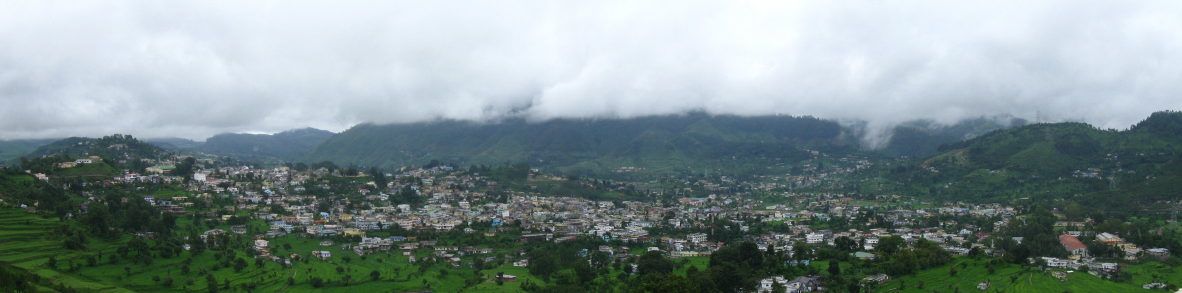
Champawatの地図
インタラクティブマップ
Champawatの人口
1975年から2020年
| Data | 1975 | 1990 | 2000 | 2015 | 2020 |
|---|---|---|---|---|---|
| 人口 | 15,513 | 24,103 | 45,036 | 52,059 | 54,491 |
| 人口密度 | 27.5 / km² | 42.7 / km² | 79.8 / km² | 92.2 / km² | 96.5 / km² |
情報源: JRC (European Commission's Joint Research Centre) の作業 GHS built-up grid
Champawatの2000年から2015年までの人口変化
2000年から2015年にかけて15.6%増加
| 場所 | 1975年以降の変化 | 1990年以降の変化 | 2000年以降の変化 |
|---|---|---|---|
| Champawat | +235.6% | +116% | +15.6% |
| ウッタラーカンド州 | +110.3% | +53.2% | +26.2% |
| インド | +111.1% | +50.6% | +24.5% |
情報源: JRC (European Commission's Joint Research Centre) の作業 GHS built-up grid
Champawatの年齢中央値
年齢中央値: 23.4歳
| 場所 | 平均年齢 | 年齢の中央値(女性) | 年齢の中央値(男性) |
|---|---|---|---|
| Champawat | 23.4 yrs | 24.3 yrs | 22.5 yrs |
| ウッタラーカンド州 | 24 yrs | 24.7 yrs | 23.3 yrs |
| インド | 24.9 yrs | 25.4 yrs | 24.5 yrs |
情報源: CIESIN (Center for International Earth Science Information Network)
Champawatの人口密度
人口密度: 96.5 / km²
| 場所 | 人口 | エリア | 密度 |
|---|---|---|---|
| Champawat | 54,491 | 564.5 km² | 96.5 / km² |
| ウッタラーカンド州 | 11.1 million | 53,694.7 km² | 207 / km² |
| インド | 1,307 million | 3,083,563.4 km² | 424 / km² |
情報源: JRC (European Commission's Joint Research Centre) の作業 GHS built-up grid
Champawatの過去および予測人口
0年から2100年までの推定人口
情報源:
- JRC (European Commission's Joint Research Centre) の作業 GHS built-up grid
- CIESIN (Center for International Earth Science Information Network)
- [リンク] Klein Goldewijk, K., Beusen, A., Doelman, J., and Stehfest, E.: Anthropogenic land use estimates for the Holocene – HYDE 3.2, Earth Syst. Sci. Data, 9, 927–953, https://doi.org/10.5194/essd-9-927-2017, 2017.
市外局番
Champawatのビジネスによって使用されている市外局番の割合
人間開発指数(HDI)
平均余命、教育、および一人当たり収入の統計的複合指数。
出典: [リンク] Kummu, M., Taka, M. &Guillaume, J. 1990年から2015年までのGDPおよび人間開発指数のグローバルグリッドデータセット. Sci Data 5, 180004 (2018) doi:10.1038/sdata.2018.4
ChampawatのCO2排出量
1人あたりの二酸化炭素(CO2)排出量(年間トン)
| 場所 | CO2排出量 | 一人当たりのCO2排出量 | CO2排出強度 |
|---|---|---|---|
| Champawat | 77,091 tn | 1.41 tn | 136.6 tons/km² |
| ウッタラーカンド州 | 18,382,127 tn | 1.66 tn | 342.3 tons/km² |
| インド | 1,928,568,344 tn | 1.48 tn | 625.4 tons/km² |
情報源: [リンク] Moran, D., Kanemoto K; Jiborn, M., Wood, R., Többen, J., and Seto, K.C. (2018) 13,000都市のカーボンフットプリント. Environmental Research Letters DOI: 10.1088/1748-9326/aac72a
ChampawatのCO2排出量
| 2013年のCO2排出量(トン/年) | 77,091 tn |
| 2013年の一人当たりCO2排出量(トン/年) | 1.41 tn |
| 2013年のCO2排出強度(トン/km²/年) | 136.6 tons/km² |
自然災害リスク
Relative risk out of 10
| ハザード | Risk Level |
|---|---|
| Drought | Medium (4.4) |
| Flood | High (8) |
| Earthquake | High (8.2) |
| Landslide | Medium (7) |
* Risk, particularly concerning flood or landslide, may not be for the entire area.
情報源:
- Dilley, M., R.S. Chen, U. Deichmann, A.L. Lerner-Lam, M. Arnold, J. Agwe, P. Buys, O. Kjekstad, B. Lyon, and G. Yetman. 2005. Natural Disaster Hotspots: A Global Risk Analysis. Washington, D.C.: World Bank. https://doi.org/10.1596/0-8213-5930-4.
- Center for Hazards and Risk Research - CHRR - Columbia University, Center for International Earth Science Information Network - CIESIN - Columbia University, and Norwegian Geotechnical Institute - NGI. 2005. Global Landslide Hazard Distribution. Palisades, NY: NASA Socioeconomic Data and Applications Center (SEDAC). https://doi.org/10.7927/H4P848VZ.
- Center for Hazards and Risk Research - CHRR - Columbia University, Center for International Earth Science Information Network - CIESIN - Columbia University, and International Research Institute for Climate and Society - IRI - Columbia University. 2005. Global Drought Hazard Frequency and Distribution. Palisades, NY: NASA Socioeconomic Data and Applications Center (SEDAC). https://doi.org/10.7927/H4VX0DFT.
- Center for Hazards and Risk Research - CHRR - Columbia University, Center for International Earth Science Information Network - CIESIN - Columbia University. 2005. Global Flood Hazard Frequency and Distribution. Palisades, NY: NASA Socioeconomic Data and Applications Center (SEDAC). https://doi.org/10.7927/H4668B3D.
- Center for Hazards and Risk Research - CHRR - Columbia University, Center for International Earth Science Information Network - CIESIN - Columbia University. 2005. Global Earthquake Hazard Distribution - Peak Ground Acceleration. Palisades, NY: NASA Socioeconomic Data and Applications Center (SEDAC). https://doi.org/10.7927/H4BZ63ZS.
最近の近くの地震
マグニチュード3.0以上
| 日付▼ | 時間↕ | Magnitude↕ | Distance↕ | 深さ↕ | 場所↕ | リンク |
|---|---|---|---|---|---|---|
| 11/11/18 | 7:07 AM | 4.5 | 85.5 km | 10,000 m | 13km NE of Dharchula, India | usgs.gov |
| 12/1/16 | 4:52 PM | 5.2 | 89.3 km | 31,960 m | 17km NNE of Dharchula, India | usgs.gov |
| 9/29/15 | 9:27 AM | 4.6 | 78.7 km | 35,000 m | 22km NW of Darchula, Nepal | usgs.gov |
| 1/22/15 | 3:42 AM | 4 | 94.8 km | 40,660 m | 17km NE of Dipayal, Nepal | usgs.gov |
| 8/24/14 | 8:29 AM | 4.4 | 78.8 km | 10,000 m | 27km NE of Bageshwar, India | usgs.gov |
| 7/7/14 | 4:37 PM | 4.4 | 99.6 km | 16,320 m | 23km NE of Dipayal, Nepal | usgs.gov |
| 7/28/12 | 5:48 AM | 4.6 | 85.2 km | 16,500 m | Nepal-India border region | usgs.gov |
| 4/4/11 | 11:31 AM | 5.3 | 76.9 km | 26,100 m | Nepal-India border region | usgs.gov |
| 7/10/10 | 3:16 AM | 4.6 | 93.8 km | 13,100 m | Uttaranchal, India | usgs.gov |
| 7/6/10 | 7:08 PM | 5 | 64 km | 32,800 m | Nepal-India border region | usgs.gov |


データについて
このページのデータは、公開されている各種ツールやリソースを用いて推定されています。保証なしで提供されており、不正確な情報が含まれる可能性があります。ご自身の責任でご利用ください。