Motulのカテゴリー
オートバイの修理ガソリンスタンドバイク ショップバイク販売業者整備士洗車自動車修理・整備自動車整備工場自動車用品ショップ車の修理トルティーヤ専門店ビール販売業者ボトルウォーター供給業者金属加工業鍛冶屋ファッション アクセサリー店女性用衣料宝石や時計服屋靴店インターネット サービス プロバイダ携帯電話ショップ電気通信事業者アッセンブリーズ・オブ・ゴッド教会カトリック教会キリスト教教会コミュニティ センター宗教団体官公庁政府機関教会郵便局携帯電話修理店ホームセンター住宅開発家電販売店工具店建材店建物の建設日用品店絵画プリスクール中学校小学校教育教育センター教育機関写真スタジオ水族館観光名所アイスクリーム店インターネットカフェエスプレッソ バーカフェケーキ屋コーヒーショップシーフードレストランタコス レストランデザート ショップバーガーレストランバー・パブ・居酒屋パブピザファーストフードレストランファミリー レストランブランチ レストランベーカリーメキシコ料理レストランユカタン料理店レストラン出前サービス宅配ピザ朝食・ブランチ洋菓子店精肉店青果店食料雑貨品店・スーパーマーケット鶏料理店家具店自転車修理・整備店苗床・庭園商品ATM信用組合法律事務送金サービス金融機関銀行内科診療所医療研究所墓地栄養士歯医者獣医師病院眼鏡技師とアイウェア総合病院診療所マニキュアとペディキュア理髪店美容院美容院事務用品・文房具店広告代理店ファンクション ルーム施設不動産仲介業団地集合住宅ギフト ショップコンビニエンスストアショッピングショッピング モールスーパーソフトドリンク店デパートノベルティ専門店ビール専門店ロシア食料品店化粧品店宝飾品・時計・貴金属小売植物園生花店紙店薬局質屋酒屋雑貨店スポーツジムスポーツ同好会公共公園自転車遊び場野球場ヴィラタクシーホテル・モーテル住宅組合宿泊施設観光牧場運輸サービス手の届かないもの
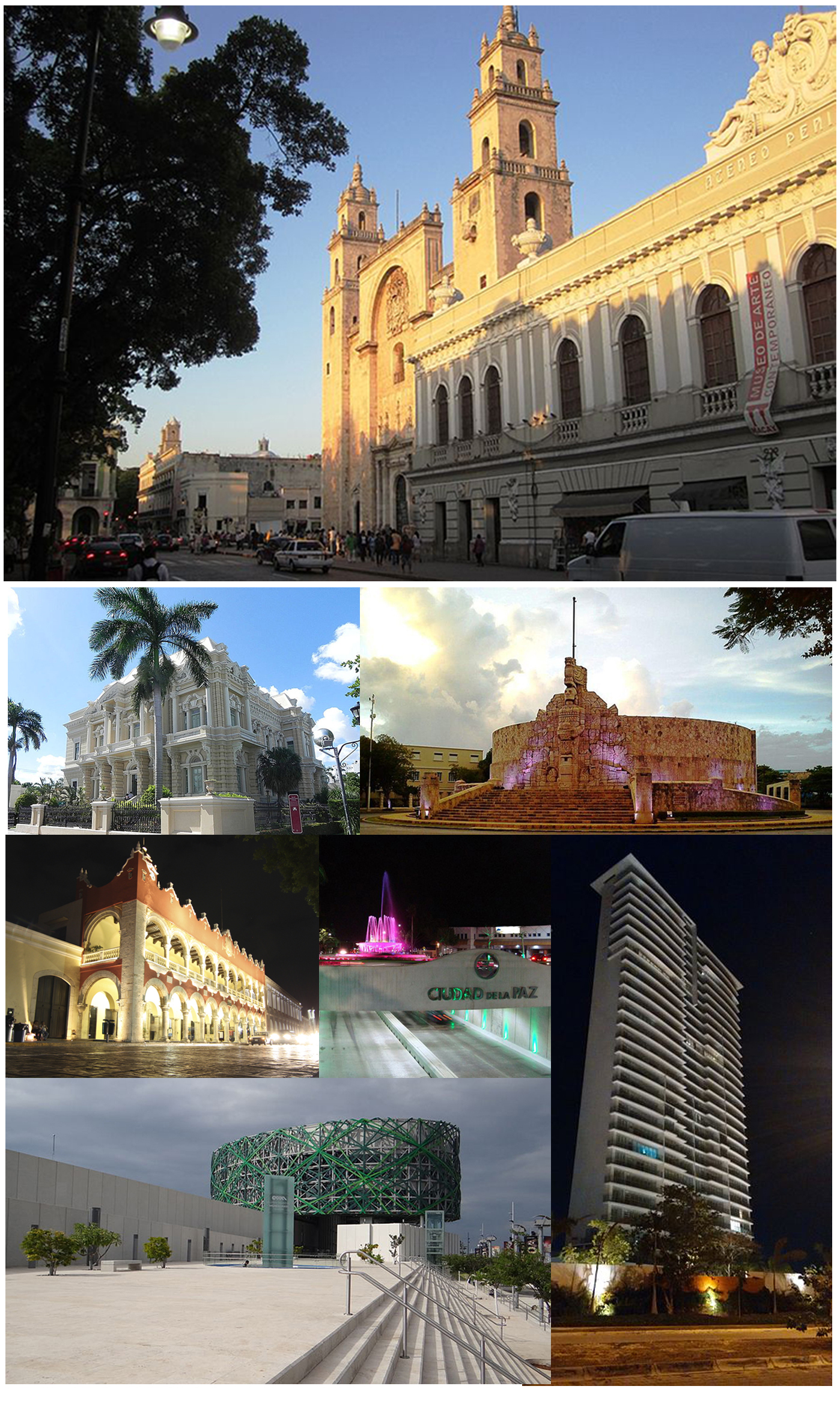
産業
Motulにおける業界別ビジネス分布
Motulの地図
インタラクティブマップ
Motulの人口
1975年から2020年
| Data | 1975 | 1990 | 2000 | 2015 | 2020 |
|---|---|---|---|---|---|
| 人口 | 11,896 | 17,711 | 21,530 | 25,705 | 27,250 |
| 人口密度 | 910.7 / km² | 1,355.9 / km² | 1,648.2 / km² | 1,967.8 / km² | 2,086.1 / km² |
情報源: JRC (European Commission's Joint Research Centre) の作業 GHS built-up grid
Motulの2000年から2015年までの人口変化
2000年から2015年にかけて19.4%増加
| 場所 | 1975年以降の変化 | 1990年以降の変化 | 2000年以降の変化 |
|---|---|---|---|
| Motul | +116.1% | +45.1% | +19.4% |
| ユカタン州 | +100.7% | +41.4% | +18.9% |
| メキシコ | +108.7% | +48.4% | +23.5% |
情報源: JRC (European Commission's Joint Research Centre) の作業 GHS built-up grid
Motulの年齢中央値
年齢中央値: 27.3歳
| 場所 | 平均年齢 | 年齢の中央値(女性) | 年齢の中央値(男性) |
|---|---|---|---|
| Motul | 27.3 yrs | 27.8 yrs | 26.7 yrs |
| ユカタン州 | 26.9 yrs | 27.5 yrs | 26.3 yrs |
| メキシコ | 26.2 yrs | 27 yrs | 25.3 yrs |
情報源: CIESIN (Center for International Earth Science Information Network)
Motulの人口密度
人口密度: 2,086 / km²
| 場所 | 人口 | エリア | 密度 |
|---|---|---|---|
| Motul | 27,250 | 13.1 km² | 2,086 / km² |
| ユカタン州 | 2.2 million | 39,871.5 km² | 54.2 / km² |
| メキシコ | 126.8 million | 1,965,208 km² | 64.5 / km² |
情報源: JRC (European Commission's Joint Research Centre) の作業 GHS built-up grid
Motulの過去および予測人口
0年から2100年までの推定人口
情報源:
- JRC (European Commission's Joint Research Centre) の作業 GHS built-up grid
- CIESIN (Center for International Earth Science Information Network)
- [リンク] Klein Goldewijk, K., Beusen, A., Doelman, J., and Stehfest, E.: Anthropogenic land use estimates for the Holocene – HYDE 3.2, Earth Syst. Sci. Data, 9, 927–953, https://doi.org/10.5194/essd-9-927-2017, 2017.
Motulの地区
Motulの地区別の企業の割合
価格分布
Motulの価格によるビジネスの分布
人間開発指数(HDI)
平均余命、教育、および一人当たり収入の統計的複合指数。
出典: [リンク] Kummu, M., Taka, M. &Guillaume, J. 1990年から2015年までのGDPおよび人間開発指数のグローバルグリッドデータセット. Sci Data 5, 180004 (2018) doi:10.1038/sdata.2018.4
MotulのCO2排出量
1人あたりの二酸化炭素(CO2)排出量(年間トン)
| 場所 | CO2排出量 | 一人当たりのCO2排出量 | CO2排出強度 |
|---|---|---|---|
| Motul | 105,327 tn | 3.87 tn | 8,063.3 tons/km² |
| ユカタン州 | 8,227,733 tn | 3.81 tn | 206.4 tons/km² |
| メキシコ | 496,865,013 tn | 3.92 tn | 252.8 tons/km² |
情報源: [リンク] Moran, D., Kanemoto K; Jiborn, M., Wood, R., Többen, J., and Seto, K.C. (2018) 13,000都市のカーボンフットプリント. Environmental Research Letters DOI: 10.1088/1748-9326/aac72a
MotulのCO2排出量
| 2013年のCO2排出量(トン/年) | 105,327 tn |
| 2013年の一人当たりCO2排出量(トン/年) | 3.87 tn |
| 2013年のCO2排出強度(トン/km²/年) | 8,063.3 tons/km² |
自然災害リスク
Relative risk out of 10
| ハザード | Risk Level |
|---|---|
| Drought | Medium (4) |
| Flood | High (8) |
| Cyclone | Medium (7) |
* Risk, particularly concerning flood or landslide, may not be for the entire area.
情報源:
- Dilley, M., R.S. Chen, U. Deichmann, A.L. Lerner-Lam, M. Arnold, J. Agwe, P. Buys, O. Kjekstad, B. Lyon, and G. Yetman. 2005. Natural Disaster Hotspots: A Global Risk Analysis. Washington, D.C.: World Bank. https://doi.org/10.1596/0-8213-5930-4.
- Center for Hazards and Risk Research - CHRR - Columbia University, Center for International Earth Science Information Network - CIESIN - Columbia University, International Bank for Reconstruction and Development - The World Bank, and United Nations Environment Programme Global Resource Information Database Geneva - UNEP/GRID-Geneva. 2005. Global Cyclone Hazard Frequency and Distribution. Palisades, NY: NASA Socioeconomic Data and Applications Center (SEDAC). https://doi.org/10.7927/H4CZ353K.
- Center for Hazards and Risk Research - CHRR - Columbia University, Center for International Earth Science Information Network - CIESIN - Columbia University, and International Research Institute for Climate and Society - IRI - Columbia University. 2005. Global Drought Hazard Frequency and Distribution. Palisades, NY: NASA Socioeconomic Data and Applications Center (SEDAC). https://doi.org/10.7927/H4VX0DFT.
- Center for Hazards and Risk Research - CHRR - Columbia University, Center for International Earth Science Information Network - CIESIN - Columbia University. 2005. Global Flood Hazard Frequency and Distribution. Palisades, NY: NASA Socioeconomic Data and Applications Center (SEDAC). https://doi.org/10.7927/H4668B3D.


データについて
このページのデータは、公開されている各種ツールやリソースを用いて推定されています。保証なしで提供されており、不正確な情報が含まれる可能性があります。ご自身の責任でご利用ください。