産業
ギセニにおける業界別ビジネス分布
ギセニのデータ
| エリア | 10.2 km² |
| 人口 | 83,861 |
| 男性人口 | 42,127 (50.2%) |
| 女性人口 | 41,734 (49.8%) |
| 人口変化 (1975 to 2020) | +810.2% |
| 人口変化 (2000 to 2020) | +222.6% |
| 平均年齢 | 20.2歳 (男性: 20.6, 女性: 19.9) |
| 地域 | Kiyovu |
| 現地時間 | |
| 時間帯 | 中央アフリカ時間 |
| 緯度と経度 | -1.70278, 29.25639 |
ギセニの地図
インタラクティブマップ
ギセニの人口
1975年から2020年
| Data | 1975 | 1990 | 2000 | 2015 | 2020 |
|---|---|---|---|---|---|
| 人口 | 9,213 | 22,958 | 25,992 | 75,544 | 83,861 |
| 人口密度 | 904.3 / km² | 2,253.5 / km² | 2,551.4 / km² | 7,415.4 / km² | 8,231.8 / km² |
情報源: JRC (European Commission's Joint Research Centre) の作業 GHS built-up grid
ギセニの2000年から2015年までの人口変化
2000年から2015年にかけて190.6%増加
| 場所 | 1975年以降の変化 | 1990年以降の変化 | 2000年以降の変化 |
|---|---|---|---|
| ギセニ | +720% | +229.1% | +190.6% |
| 西部州 (ルワンダ) | +140.7% | +39.4% | +30.6% |
| ルワンダ | +166.7% | +59.8% | +44.7% |
情報源: JRC (European Commission's Joint Research Centre) の作業 GHS built-up grid
ギセニの年齢中央値
年齢中央値: 20.2歳
| 場所 | 平均年齢 | 年齢の中央値(女性) | 年齢の中央値(男性) |
|---|---|---|---|
| ギセニ | 20.2 yrs | 19.9 yrs | 20.6 yrs |
| 西部州 (ルワンダ) | 18.2 yrs | 19.2 yrs | 17.2 yrs |
| ルワンダ | 19.2 yrs | 19.8 yrs | 18.5 yrs |
情報源: CIESIN (Center for International Earth Science Information Network)
ギセニの人口密度
人口密度: 8,232 / km²
| 場所 | 人口 | エリア | 密度 |
|---|---|---|---|
| ギセニ | 83,861 | 10.2 km² | 8,232 / km² |
| 西部州 (ルワンダ) | 2.6 million | 4,871.6 km² | 542 / km² |
| ルワンダ | 11.6 million | 25,291.9 km² | 459 / km² |
情報源: JRC (European Commission's Joint Research Centre) の作業 GHS built-up grid
ギセニの過去および予測人口
1920年から2100年までの推定人口
情報源:
- JRC (European Commission's Joint Research Centre) の作業 GHS built-up grid
- CIESIN (Center for International Earth Science Information Network)
- [リンク] Klein Goldewijk, K., Beusen, A., Doelman, J., and Stehfest, E.: Anthropogenic land use estimates for the Holocene – HYDE 3.2, Earth Syst. Sci. Data, 9, 927–953, https://doi.org/10.5194/essd-9-927-2017, 2017.
価格分布
ギセニの価格によるビジネスの分布
人間開発指数(HDI)
平均余命、教育、および一人当たり収入の統計的複合指数。
出典: [リンク] Kummu, M., Taka, M. &Guillaume, J. 1990年から2015年までのGDPおよび人間開発指数のグローバルグリッドデータセット. Sci Data 5, 180004 (2018) doi:10.1038/sdata.2018.4
ギセニのCO2排出量
1人あたりの二酸化炭素(CO2)排出量(年間トン)
| 場所 | CO2排出量 | 一人当たりのCO2排出量 | CO2排出強度 |
|---|---|---|---|
| ギセニ | 18,008 tn | 0.21 tn | 1,767.7 tons/km² |
| 西部州 (ルワンダ) | 489,511 tn | 0.19 tn | 100.5 tons/km² |
| ルワンダ | 2,116,974 tn | 0.18 tn | 83.7 tons/km² |
情報源: [リンク] Moran, D., Kanemoto K; Jiborn, M., Wood, R., Többen, J., and Seto, K.C. (2018) 13,000都市のカーボンフットプリント. Environmental Research Letters DOI: 10.1088/1748-9326/aac72a
ギセニのCO2排出量
| 2013年のCO2排出量(トン/年) | 18,008 tn |
| 2013年の一人当たりCO2排出量(トン/年) | 0.21 tn |
| 2013年のCO2排出強度(トン/km²/年) | 1,767.7 tons/km² |
自然災害リスク
Relative risk out of 10
| ハザード | Risk Level |
|---|---|
| Flood | High (9) |
| Earthquake | Medium (4) |
* Risk, particularly concerning flood or landslide, may not be for the entire area.
情報源:
- Dilley, M., R.S. Chen, U. Deichmann, A.L. Lerner-Lam, M. Arnold, J. Agwe, P. Buys, O. Kjekstad, B. Lyon, and G. Yetman. 2005. Natural Disaster Hotspots: A Global Risk Analysis. Washington, D.C.: World Bank. https://doi.org/10.1596/0-8213-5930-4.
- Center for Hazards and Risk Research - CHRR - Columbia University, Center for International Earth Science Information Network - CIESIN - Columbia University. 2005. Global Flood Hazard Frequency and Distribution. Palisades, NY: NASA Socioeconomic Data and Applications Center (SEDAC). https://doi.org/10.7927/H4668B3D.
- Center for Hazards and Risk Research - CHRR - Columbia University, Center for International Earth Science Information Network - CIESIN - Columbia University. 2005. Global Earthquake Hazard Distribution - Peak Ground Acceleration. Palisades, NY: NASA Socioeconomic Data and Applications Center (SEDAC). https://doi.org/10.7927/H4BZ63ZS.
最近の近くの地震
マグニチュード3.0以上
| 日付▼ | 時間↕ | Magnitude↕ | Distance↕ | 深さ↕ | 場所↕ | リンク |
|---|---|---|---|---|---|---|
| 8/5/19 | 9:37 AM | 4.4 | 94.4 km | 10,000 m | 18km W of Ntungamo, Uganda | usgs.gov |
| 10/1/18 | 5:58 AM | 4.4 | 88 km | 10,000 m | 42km W of Ntungamo, Uganda | usgs.gov |
| 1/9/18 | 9:01 AM | 4.5 | 90.1 km | 10,000 m | 67km W of Sake, Democratic Republic of the Congo | usgs.gov |
| 2/4/16 | 12:43 PM | 5.1 | 94.4 km | 10,000 m | 69km W of Sake, Democratic Republic of the Congo | usgs.gov |
| 8/7/15 | 1:50 AM | 4.3 | 77.8 km | 10,000 m | 21km N of Kabare, Democratic Republic of the Congo | usgs.gov |
| 8/7/15 | 1:28 AM | 5.5 | 54.7 km | 10,000 m | 43km N of Cyangugu, Rwanda | usgs.gov |
| 8/7/15 | 1:25 AM | 5.8 | 62.8 km | 11,000 m | 37km N of Cyangugu, Rwanda | usgs.gov |
| 2/2/12 | 2:54 AM | 4.7 | 84.3 km | 10,000 m | Lac Kivu region, Democratic Republic of the Congo | usgs.gov |
| 1/28/10 | 11:52 PM | 4.9 | 88.9 km | 10,000 m | Lake Edward region, Congo-Uganda | usgs.gov |
| 3/25/09 | 5:03 AM | 4 | 89.3 km | 10,000 m | Rwanda | usgs.gov |
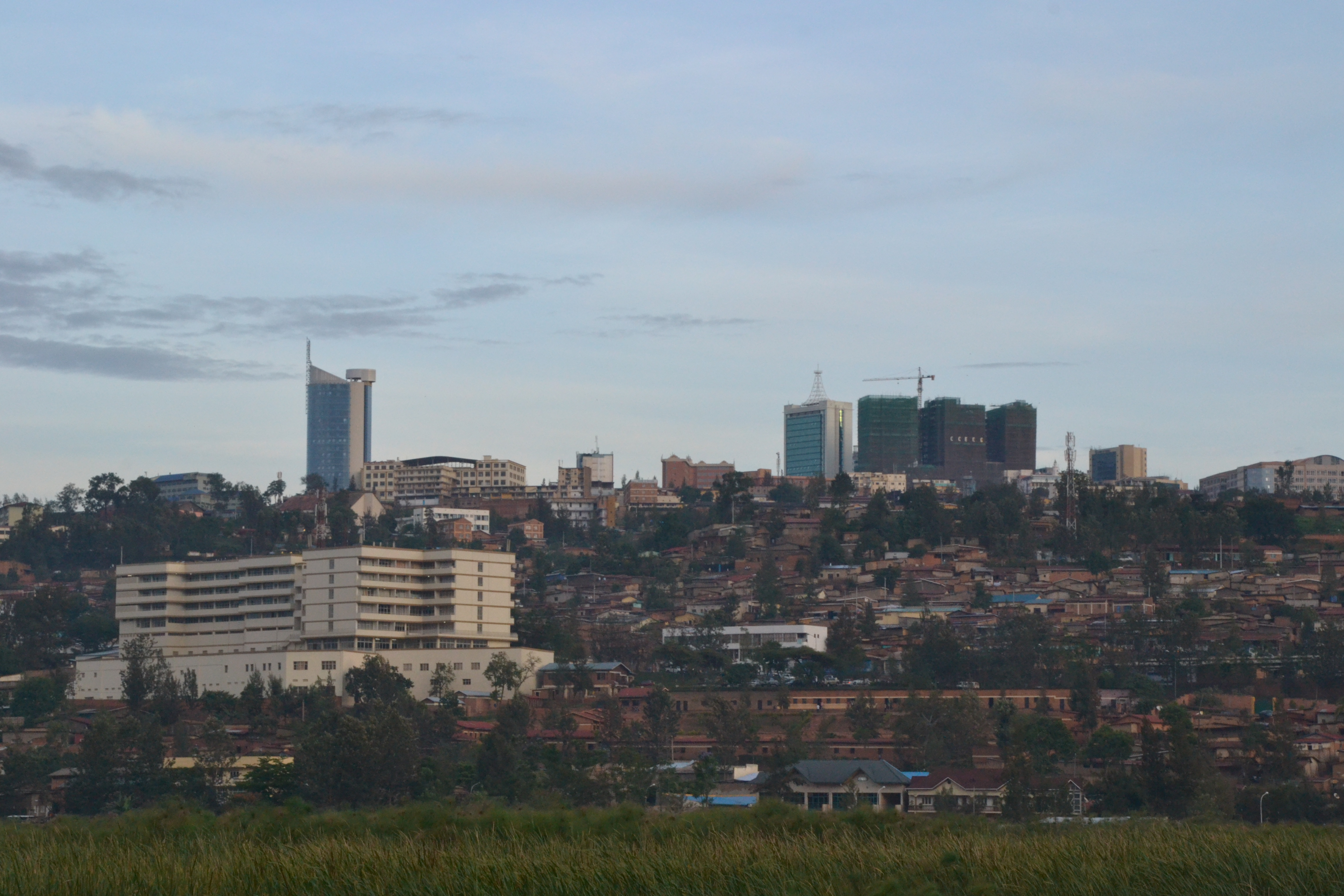
ギセニ
ギセニ(Gisenyi)は、ルワンダ 西部州の都市。かつてはギセニ県の中心都市であった(2006年、ギセニ県は西部州に再編された)。キブ湖岸に位置しており、対岸はコンゴ民主共和国となっている。砂浜のあるリゾートで、ウォータースポーツやブルワリーも有名である。 (大量虐殺..
ギセニのウィキペディアページ


データについて
このページのデータは、公開されている各種ツールやリソースを用いて推定されています。保証なしで提供されており、不正確な情報が含まれる可能性があります。ご自身の責任でご利用ください。